Langkawi is renowned for its white sand beaches, spectacular sunsets and, of course, its duty-free status - it is very much a holiday destination. But this collection of islands also boasts mangrove forests, karst rock formations, waterfalls and plenty of wildlife. In fact, the entire place is the first 'UNESCO Global Geopark' in Southeast Asia.
 |
| Kilim Karst Geoforest Park |
Staying on Langkawi Island for 5 days, we hit the optimum level of 'beach chills' versus activities. The itinerary included relaxing on the beach, watching multiple Tanjung Rhu sunsets, a trip to the Sky Bridge, a visit to a waterfall and a tour around the Kilim Geoforest Park.
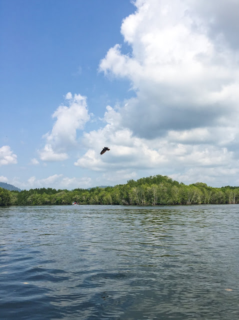
Situated in the Malaysian state of Kedah, Langkawi is the collective name for a cluster of 99 islands in the Andaman Sea off the coast of Western Malaysia. 'Pulau Langkawi', or 'Langkawi Island', is the name of the largest island. As the taxi driver informed us on our ride from the airport, 'Langkawi' means 'Brown Eagle' - and there are plenty of these birds on the island. At the Kilim Geoforest Park, which is one of the designated areas of protection on Langkawi, you can observe as Brahminy Kite and White-bellied Sea Eagles dive for fish.
 |
| Kilim Karst Geoforest Park |
|
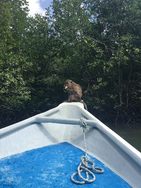 |
| Be prepared to encounter Macaques as the boats wades through the mangrove forest. |
|
I should note that whilst in Langkawi, I saw the the beginnings of eco-tourism scattered around the island. Initiatives such as this are much needed, as the environment is in danger of suffering under the effects of mass tourism. Perhaps the growing market of eco-tourism as well as its status as a UNESCO protected site will help curb the problem and strike the balance between building a successful tourism industry and conserving the unique landscape that draws so many to the island.
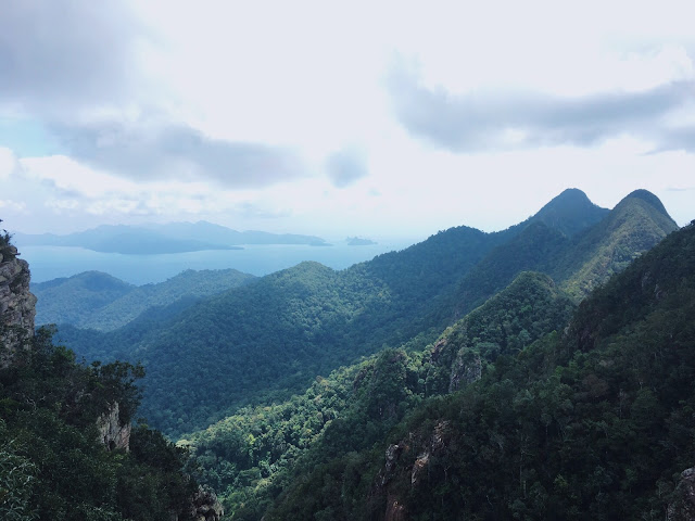 |
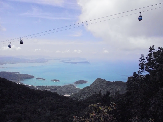
| Langkawi Sky Bridge |
So what does 'UNESCO Global Geopark' mean? In short, UNESCO (the United Nations Educational, Scientific and Cultural Organisation) created a network of 'geoparks' in 2004. These are defined as a single, unified geographical area of international geological, biological and archaeological significance. UNESCO's network of geoparks aims to combine conservation with sustainable development for local communities.
The Langkawi Geopark has limestone formations that are over 500 million years old and, to get a bit technical, has the best exposed and most complete Palaeozoic sedimentary sequence in Malaysia. As part of the UNESCO site, the Kilim Karst Geopark, situated on the north-east of Langkawi Island, helps maintain the geodiversity and biodiversity of the area. A range of habitats can be experienced at the Kilim Geopark - mangroves, caves, beaches and more. You spend the majority of the trip in a small boat, which can be hired through tour companies or privately.
 |
|
|
There are many other ways to enjoy the natural beauty of Langkawi. On the west side of the main island is the Sky Bridge where the geo-diversity of the island can be viewed from up high. Accessed by a cable car ride (click
here for details), the 410ft bridge is suspended between two mountain peaks and has stunning views. Whilst in this area, head to the nearby 'Seven Wells' Waterfall. There are two sections that can be visited, both accessed easily via a path through the forest.
So, while this island is a beach-bum's paradise, Pulau Langkawi also offers many inland gems. All of these are reasons to drag yourself off your beach towel and enjoy the natural delights of the 'Jewel of Kedah'.
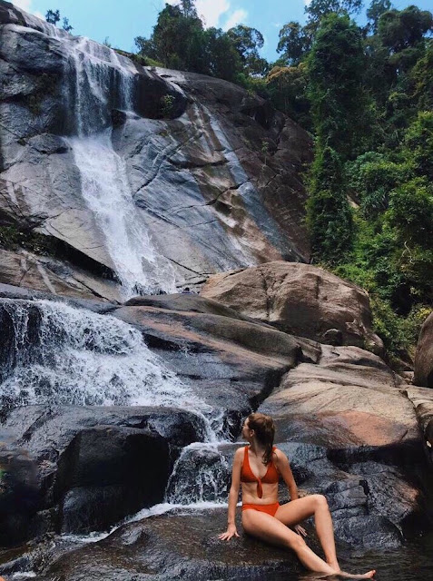 |
| Seven Wells Waterfall |
Top tip: Go to Seven Wells in the morning to avoid the crowds and get that perfect Peter Andre shot under the 'fall.


